
Port Hawkesbury Community Trails

Port Hawkesbury Community Trails
A lot with a little
Port Hawkesbury, Nova Scotia is home to a wonderful network of nature trails, which offer a year-round experience for walkers, hikers, and cross-country skiers.
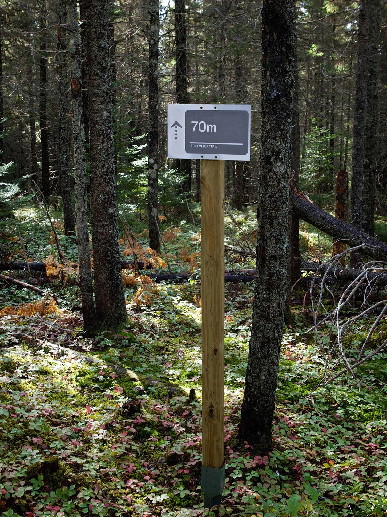
The graphic design team had the pleasure of designing a series of information and orientation signs along the 10-kilometre trail system. There are seven trails in total, each of which now has an entrance sign summarizing the trail’s distance and estimated walking time, and rules and regulations. A series of smaller signs gently update the trail user on their location and remaining distance as they weave through the natural environment.
Working with a limited budget—just over $7,500 (CDN) for the fabrication of 45 signs—the team designed and coordinated the production and delivery of every panel. Posts were acquired by the community and the system was installed by trail volunteers.
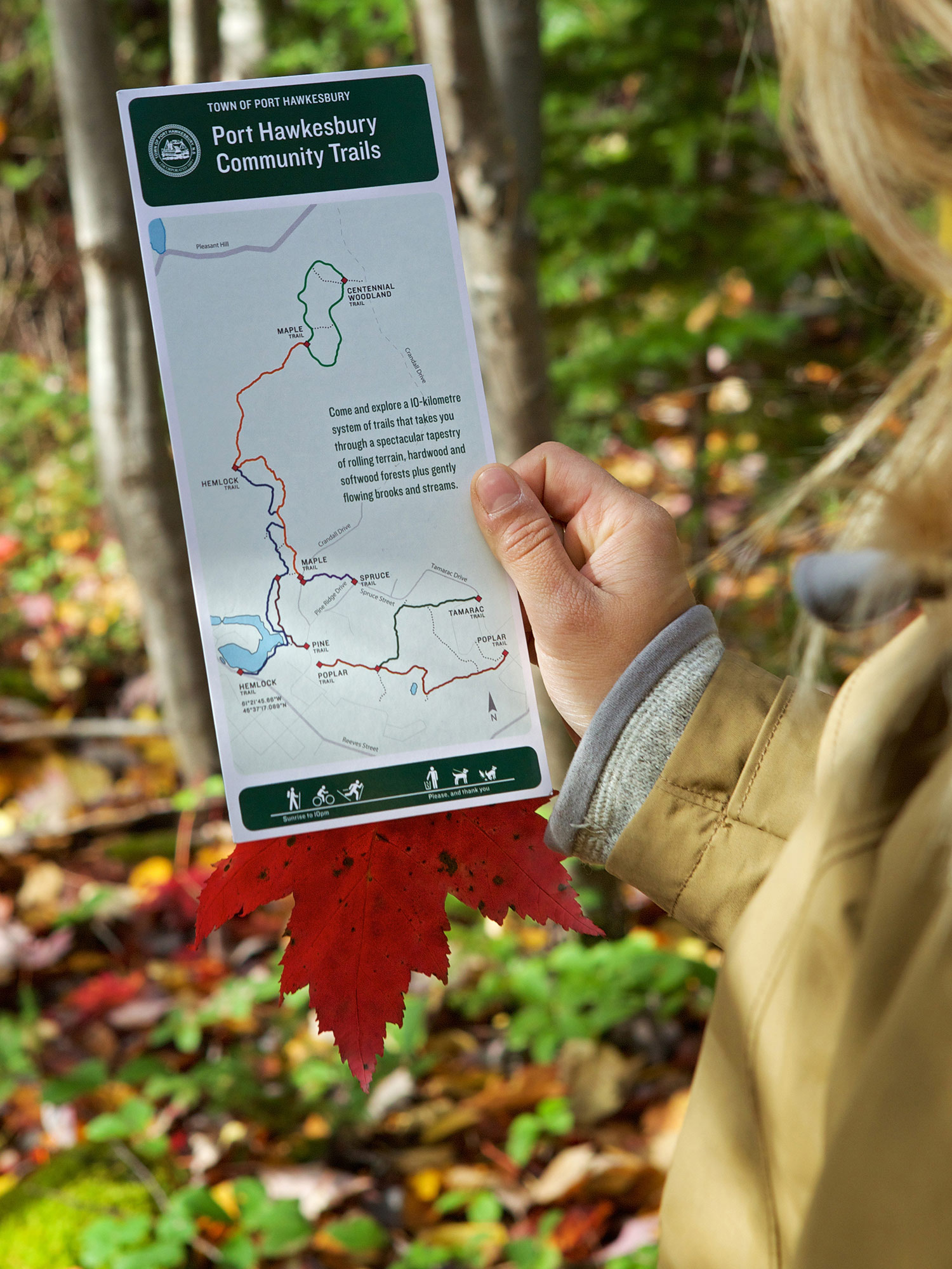
As an added incentive, the design team developed a rack card that neatly reviews the entire trail system and its many uses to outdoor enthusiasts.
Status
2014–15 (strategy)
Our Role
strategy, branding, wayfinding, graphic design
Client
Town of Port Hawkesbury
Location
Port Hawkesbury, Nova Scotia
Trail
10-kilometre trail system
Awards
2015
Canadian Regional Design Awards (Redgees) - Miscellaneous, Best in Category

ENTRANCE IDENTIFICATION
Working with an existing planter, we resurfaced the trail sign, and added trail information and a map. Colour coding and name reinforcement are used to identify the seven trails within the network.
PRINT COLLATERAL
Printed rack cards are available at visitor information centres present the network of seven trails, along with trail usage information.

TRAIL HEAD SIGNAGE
Trail head signs include maps—oriented based on location—travel distance, estimated time of travel, and “Please and Thank You” information.

DIRECTIONAL SIGNAGE
Directional signs along pathway junctions help users stay on course by communicating trail name along with distance and direction of travel.

ASSURANCE SIGNAGE
Assurance signs located along trails at key points communicate distance to trail origin and terminus.
CONNECTOR ROUTES
Neutral grey signs are used for connector routes or cul-de-sacs. Messages communicate distance to end or next path.
CREDIT
Photos (all photos this page): © Photos: Scotty Sherin.