
Town of Lunenburg

Town of Lunenburg
Historic Solution
It’s a question that challenges so many heritage towns: how do you add anything to your community—like buildings and signs—that respects the past while being relevant to modern times?
That’s the question we wrestled with when we began planning a wayfinding system for the town of Lunenburg. The town is a living time capsule, with abundant history and heritage buildings dating back to Nova Scotia’s earliest days. Should the new signage reflect the 18th century surroundings—or should it take a more modern approach?
For this project, Fathom had the pleasure of working with Gerry Rolfson, retired architect and longtime Lunenburg resident. Gerry has enjoyed a very active post-career, often volunteering his time and professional experience on local boards. Gerry is the current chair of the Lunenburg Waterfront Association, and offered advice to our designers.
Our solution came as a surprise to some, and can be best described as modern and contemporary. Thus, the town’s history and heritage shows up in the text on the signs.
Initially, not everyone agreed on this solution. But Gerry understood this approach and the reasoning behind it. “Any signage or architecture should reflect the best practices of the time. That creates the charm of a place. It’s respectful.”
With the wayfinding system now in place, Gerry could see the benefits working right before his eyes. “I can watch groups of people clustered around them. The signs melt into the background…but pop up when people are looking for them. They are very low-key until you get closer and see how much useful information they offer.”
Next time you’re in Lunenburg, head downtown and check out this present-time solution to an age-old problem. And see for yourself how the past and present can mingle perfectly together.
Status
2014–15 (pedestrian wayfinding)
2015 (vehicular wayfinding and trail signage)
Our Role
Wayfinding, interpretive planning
Client
Lunenburg Board of Trade
Location
Lunenburg, Nova Scotia
Subconsultants
Ralph Getson—copy writing. Thomas Miko—cartography (pedestrian directional); Stephen Bishop: cartography (map kiosk); Iain MacLeod—copy writing and copy editor. Atlantex Creative Works: Fabrication; Eye Catch Signs: Installation.
Awards
2015 - Canadian Regional Design Awards (Redgees): Advertising Design: Outdoor, Best in Category

TOWN OF LUNENBURG PEDESTRIAN WAYFINDING SYSTEM
The design team took special pride and satisfaction in this project, knowing they were contributing to the enhancement of a world-renowned heritage site. They purposefully choose typefaces that are suggestive of eras past, and a colour palette that would not detract from the town’s brightly coloured houses. The sign’s slender vertical form fits the very narrow pedestrian corridor, often bustling with visitors in the summer season. Located at key corners and junctions throughout the town, the signs share historical information and directions to buildings of interest and the area’s main attractions.

EXPLORE LUNENBURG
The signage system promotes walking from the downtown core through to less explored residential areas

CARDINAL DIRECTIONS
These 6” aluminum posts, painted in two tones of grey, include cardinal directions and text establishing the significance of the UNESCO World Heritage Site.

MAPS ENCOURAGING NORTH-SOUTH CIRCULATION
Each side includes: a silk-screened image or text; street name; town and zone map; UNESCO information; and noted buildings of significance in the immediate vicinity.

NARROW CORRIDOR
Given the congested nature of the built environment—with houses fronting the sidewalk along with street furniture—the signage footprint needed to be compact.

UPDATED ANNUALLY
Map kiosks sited in open areas give an overview of the town and communicate events and amenities. Printed maps use similar artwork.

A MULTI-LINGUAL WELCOME
The reverse side of the map kiosks use photography to establish how little the town has changed and includes welcoming messages and text

RESPECT OF SITE
Like the pedestrian directional signage, the map kiosks are prominent when required and inconspicuous when not.

SIGNAGE SUPPORTS COMMERCE
We worked closely with their Board of Trade to ensure all products shared the same objective — to encourage lengthier stays within the town. Maps, available throughout the region, have attractions on one-side, and a commercial operations on the other. Directional signage encourages exploration of the town.

ENCOURAGING WALKING
Customized maps show important stops within a few minutes' walk, while interpretive text introduces visitors to the Lunenburg story, building on the UNESCO World Heritage Site's strong historic brand.
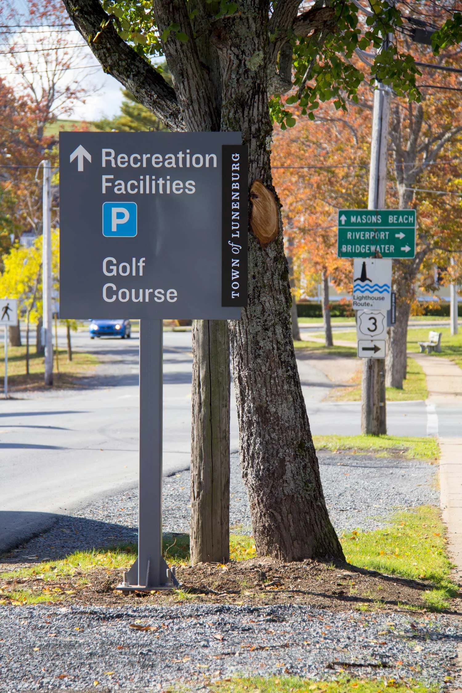
FROM CAR TO FOOT
The second phase introduced signs to help people in cars find their way into town, to parking spots, and once out of their cars, to the town’s many commercial, cultural and heritage destinations.
CREDITS
Photography: Scotty Sherin